


Our RESEARCH
The research and development activity of the Laboratory is classified into 3 thematic areas:
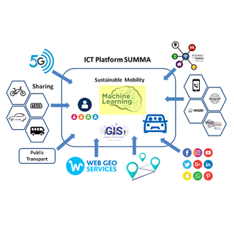
Geomatics
Geomatic Engineering, Geospatial Engineering is a discipline that focuses on spatial information.
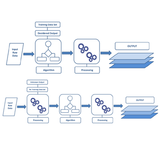
Machine Learning
Study of computer algorithms that improve automatically through experience.
Computer Science
Use of algorithms to manipulate, store, and communicate digital information.
ABOUT US
Who We Are
LabGeoInf was born with the aim to find innovative solutions by adopting the experience of research.


LATEST NEWS
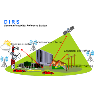
Mobility – Rome metropolitan city
from out to Rome in Rome
Qualification Certificate
L1 RINA certificate L1 RINA certificate L2 RINA certificate L2 RINA certificate L3 RINA certificate L3 RINA certificate BV-Accredia certificate L2 CIV-21-00577-C-VT BV-Accredia certificate L3 CIV-21-00747_VT_3 BV-Accredia Base Test L3 CIV-21-00746-C_BASE_test
LabGeoInf vs INSPIRE
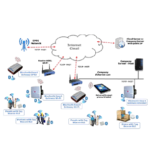
Network services and spatial data services: Web service standards (e.g. OGC, ISO, OASIS, W3C) Networking Expertise: Analysis and modeling of domains on the subjects of Geopraphic Information Science in the field of Open Source (INSPIRE Directive with standard OGC), conceptual definitions of type architectures SDI (Spatial Data Infrastructure) and co-design.INSPIRE applications and software components Expertise: Thematic knowledge […]